About Taylor Wimpey
Taylor Wimpey was formed by the merger of George Wimpey and Taylor Woodrow in 2007. With a history dating back to the 19th Century, Taylor Wimpey is one of the largest homebuilders in the UK and aims to be the nation’s leading residential developer for creating value and delivering quality. Taylor Wimpey is passionate about working with local people, businesses, local authorities and its customers to build aspirational homes.
Find you more about Taylor Wimpey at www.taylorwimpey.co.uk.
The site
The circa 17.5 hectare (ha) site for the proposed development is located on the north-eastern edge of Hampton Magna, east of Old Budbrooke Road. The A46 forms the eastern boundary of the site. The railway line and Warwick Parkway rail station lie immediately north of the site.
The site is within the Green Belt, however it occupies a highly sustainable location on the existing settlement edge. It sits approximately 500m from the local centre of Hampton Magna, which has a range of facilities including a primary school, nursery, community centre, medical centre, pub, and small shops.
The proposed development site also provides the opportunity to facilitate new active travel links to Warwick Parkway Station.
For these reasons it is being promoted through the emerging new South Warwickshire Local Plan as a grey belt site to meet future housing needs in Warwick District.
There are two public rights of way passing through the site (W79 and WB13), and these will be retained and enhanced with landscaped public open space as part of the proposals.
The site has predominantly been in arable agricultural use and is therefore of relatively low biodiversity value. There are existing hedgerows and mature trees on the field boundaries that serve as valuable habitats and these will be retained and enhanced with additional habitat creation as part of the extensive green infrastructure proposals for the development.
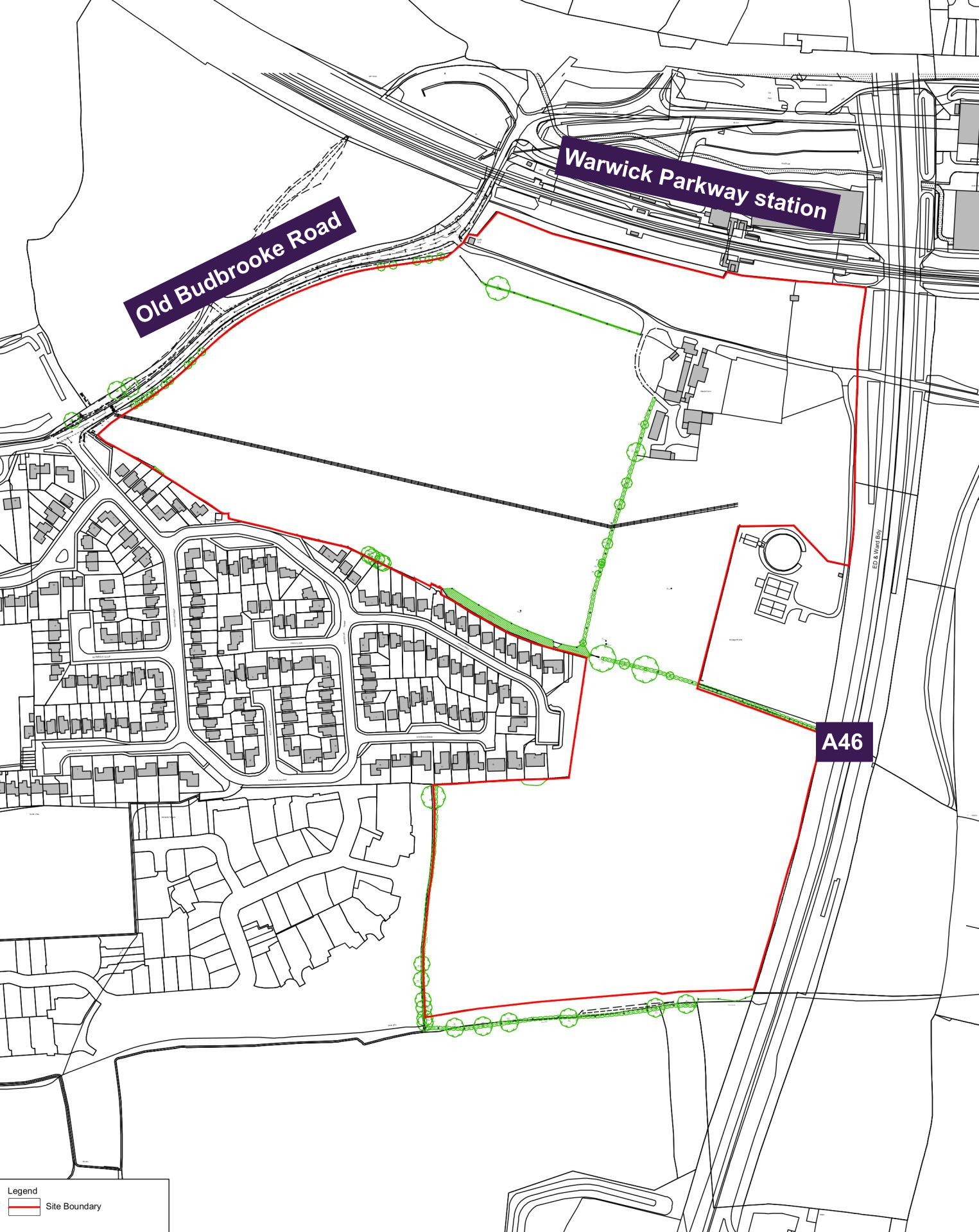
Site location plan - click to enlarge
Planning policy context
The proposed development site occupies a highly sustainable location on the edge of the settlement boundary of Hampton Magna.
Increased housing targets for Warwick District
Changes to the National Planning Policy Framework (NPPF) announced by the Government in late 2024 has significantly increased the number of homes Warwick District will need to deliver, from 653 to 1,062 homes per year.
Grey belt
A new grey belt policy was also introduced in the NPPF. This allows development in some areas of the Green Belt, provided certain criteria are met. Grey belt includes land that ‘does not strongly contribute’ to specific Green Belt purposes which are set out in the NPPF. While the site at Hampton Magna is located within the Green Belt, it occupies a highly sustainable location and meets the criteria for grey belt land having been assessed by Warwick District Council’s Local Plan evidence base as not performing strongly against Green Belt purposes. On this basis it is being promoted through the emerging new South Warwickshire Local Plan as a grey belt site to meet future housing needs in Warwick District.
Five-year housing land supply
The NPPF also requires that local authorities are able to demonstrate a five-year housing land supply. This is the amount of land that the Council must identify to ensure there are sufficient deliverable sites for residential development over the next five years. Warwick District Council has acknowledged that it currently cannot demonstrate a five-year supply of deliverable housing land. In light of this, an outline planning application for grey belt land at Hampton Magna will help to contribute to meeting this housing delivery shortfall in a sustainable location.
South Warwickshire Local Plan
Local planning authorities are required by the Government to update their Local Plans every five years. The current development plan for Warwick District was adopted in September 2017 and has now fallen significantly out of date. Warwick District Council has acknowledged it needs to prepare a new local plan and this is currently being prepared jointly with Stratford-on-Avon District Council through the emerging new South Warwickshire Local Plan.
The Council’s next stage of consultation on the new South Warwickshire Local Plan (Regulation 19) is scheduled for December 2025.
In light of the significantly increased housing targets for the district, Taylor Wimpey is preparing outline plans for the proposed development site, while continuing to promote it for inclusion in the South Warwickshire Local Plan. If the proposals are approved, this will help to ensure the delivery of homes at an early stage in the plan period, assisting Warwick District Council in maintaining housing supply to meet identified needs.
Budbrooke Neighbourhood Plan
Budbrooke Neighbourhood Plan is a locally produced document that was adopted in 2018. Policies within the neighbourhood plan are being reviewed to help inform the emerging proposals.
Local Plans are the key documents through which local planning authorities set out a vision and framework for the future development of the area, engaging with their communities in doing so. Local Plans address needs and opportunities in relation to housing, the local economy, community facilities and infrastructure. The Local Plan provides a degree of certainty for communities, businesses and investors, and a framework for guiding decisions on individual planning applications.
Local planning authorities, such as Warwick District Council, have a statutory responsibility to maintain an up-to-date Local Plan, and national policy indicates that Local Plans should be regularly reviewed, with the expectation this is done at least every five years.
Site constraints and opportunities
How local features and landscape have shaped the proposed illustrative layout of the new neighbourhood.
Landscape, drainage features, topography and local context of the site have been considered while preparing the concept layout for the proposed development.
The following plan shows some of the features and constraints that have informed the emerging outline proposals. Key features include an overhead powerline passing through the site in an east-west direction, an existing public right of way, the A46 to the east of the site, and the railway line to the north.
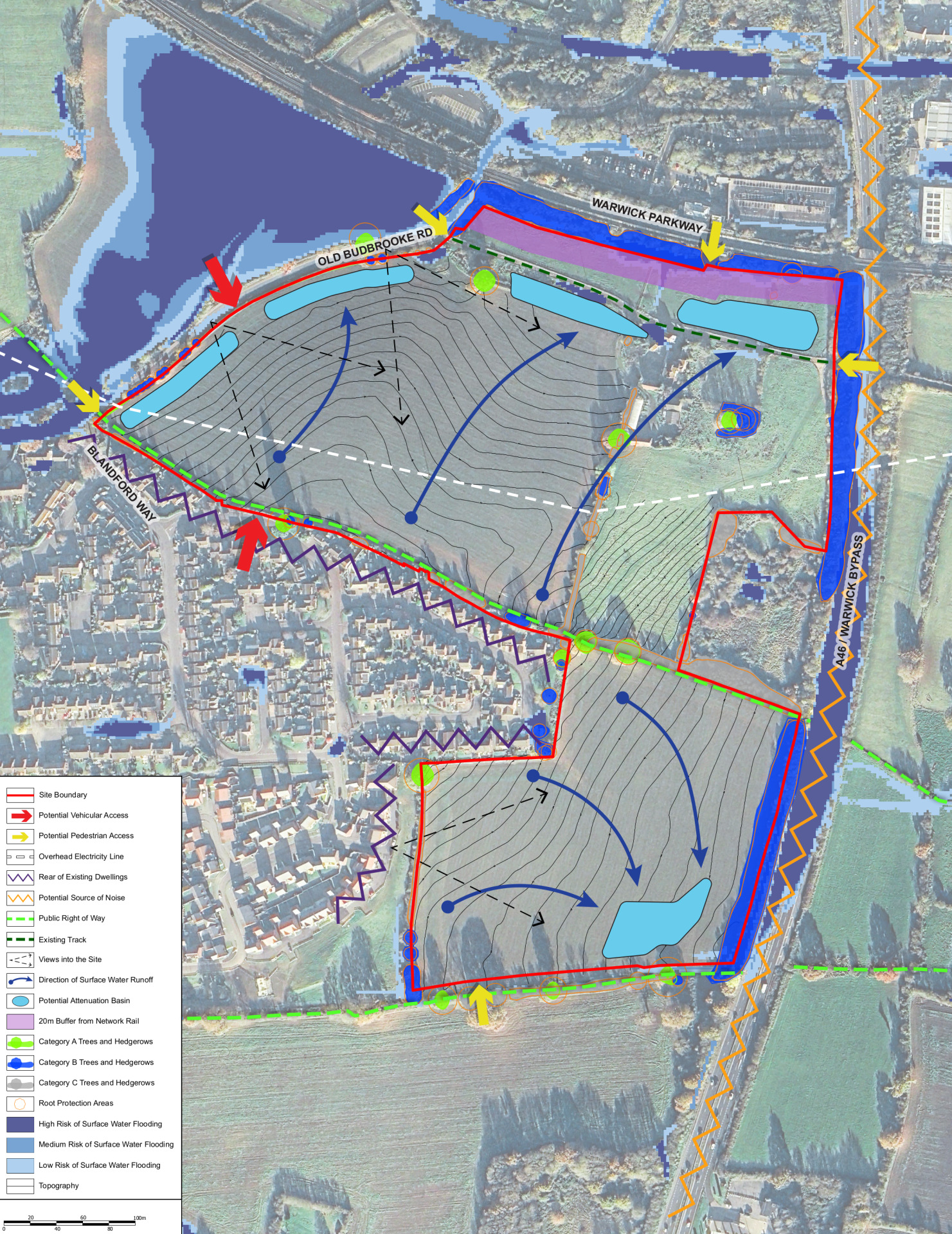
This plan shows an early analysis of some of the site features that have influenced the evolving masterplan for the site - click to enlarge
The outline vision for new homes and extensive green public open space
Taylor Wimpey is preparing an outline planning application for a sustainable new neighbourhood at the site east of Hampton Magna, including:
- Up to 360 high-quality family homes in a range of sizes and styles delivered across two distinct development areas.
- Up to 50% of homes provided as affordable housing, including shared ownership homes for first time buyers.
- Scope to provide accessible homes for local people looking to downsize.
- A significant proportion of the site retained as extensive landscaped open space including biodiversity areas.
- A range of outdoor recreational facilities including children’s play areas, a community garden/orchard and the potential to provide allotments.
- A focus on sustainable travel, with the provision of a network of new walking and cycling routes within the neighbourhood.
- Potential for a direct active travel connection through the site to Warwick Parkway rail station.
- The active travel network being provided within the site includes a connection that could facilitate an onward pedestrian/cycle connection across the A46 utilising the existing farm bridge. However, any such onward link would involve land outside our control and will therefore be dependent on the future plans of those controlling land to the east, as well as the support of the council.
- The retention and enhancement of existing public rights of way crossing the site, set within landscaped public open spaces and green corridors.
- A development shaped by existing landscape features, with the retention of existing trees and the majority of hedgerows wherever possible, enhanced by extensive new planting to significantly increase tree cover across the site.
- Primary access to the northern parcel of development from Old Budbrooke Road, with a secondary access from Arras Boulevard.
- A previously proposed vehicular access to the southern parcel of development from Gould Road has now been removed from the proposals in response to consultation feedback, with pedestrian and cycle access only now proposed at this location.
- Tree-lined street frontages within the neighbourhood.
- Investment to support local infrastructure, for example healthcare and education.
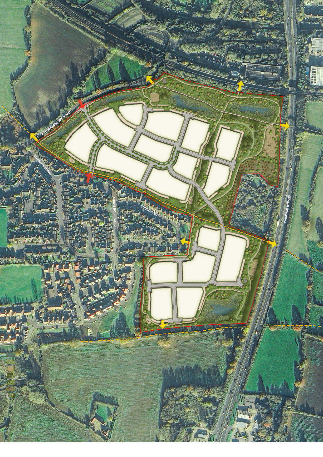
The illustrative concept layout for the new neighbourhood. Click to open interactive map
New homes
House types
The planning application is an outline planning application. This type of planning application sets out the broad principles of development, such as maximum number of homes, an illustrative layout and site access arrangements. Should outline planning permission be received, finer details such as specific house types, detailed layout, architecture etc would be subject to a subsequent further planning application (called a reserved matters planning application). This would involve further consultation with the community.
While house types would be determined at the reserved matters planning stage, we have provided imagery of existing Taylor Wimpey developments on this website to provide an idea of the types of high-quality homes we build.
Use the feedback questionnaire to tell us the types of homes you would like to see prioritised in Hampton Magna.
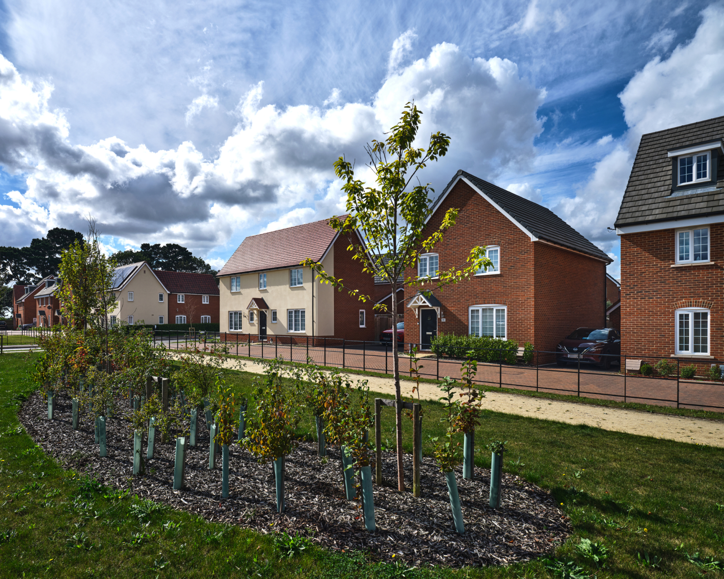
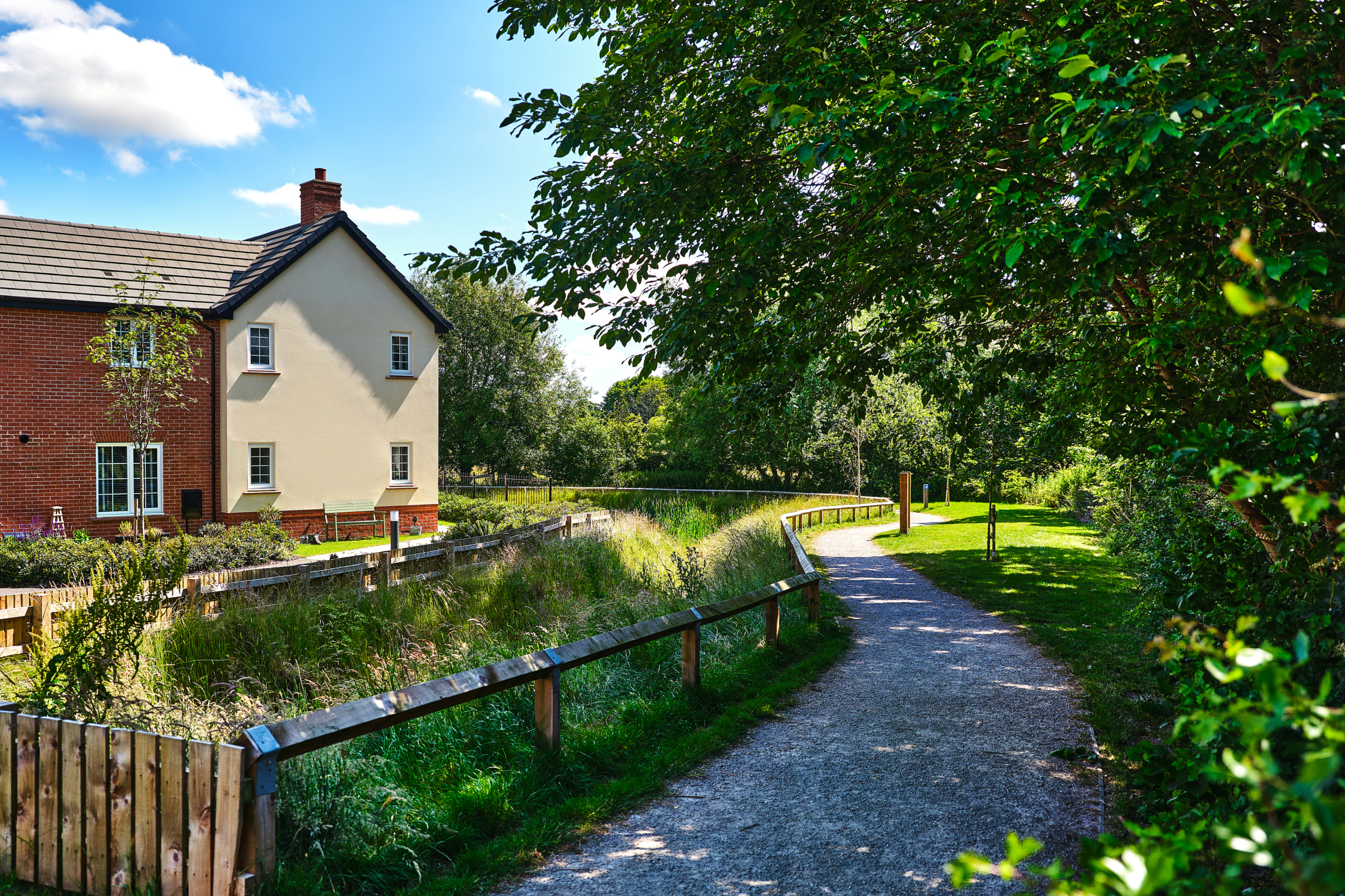
Examples of existing Taylor Wimpey developments. Click to open image gallery
Sustainable homes
Taylor Wimpey is committed to building great homes and creating thriving communities. Embedding sustainability across the business, delivering high-quality homes and places where customers can enjoy a good quality of life and adopt a more sustainable lifestyle, are key priorities.
The proposed new neighbourhood in Hampton Magna will provide energy-efficient homes built to the Future Homes Standard. This will see all homes equipped with air source heat pumps, PV (solar) panels, EV charging points and very high standards of insulation.
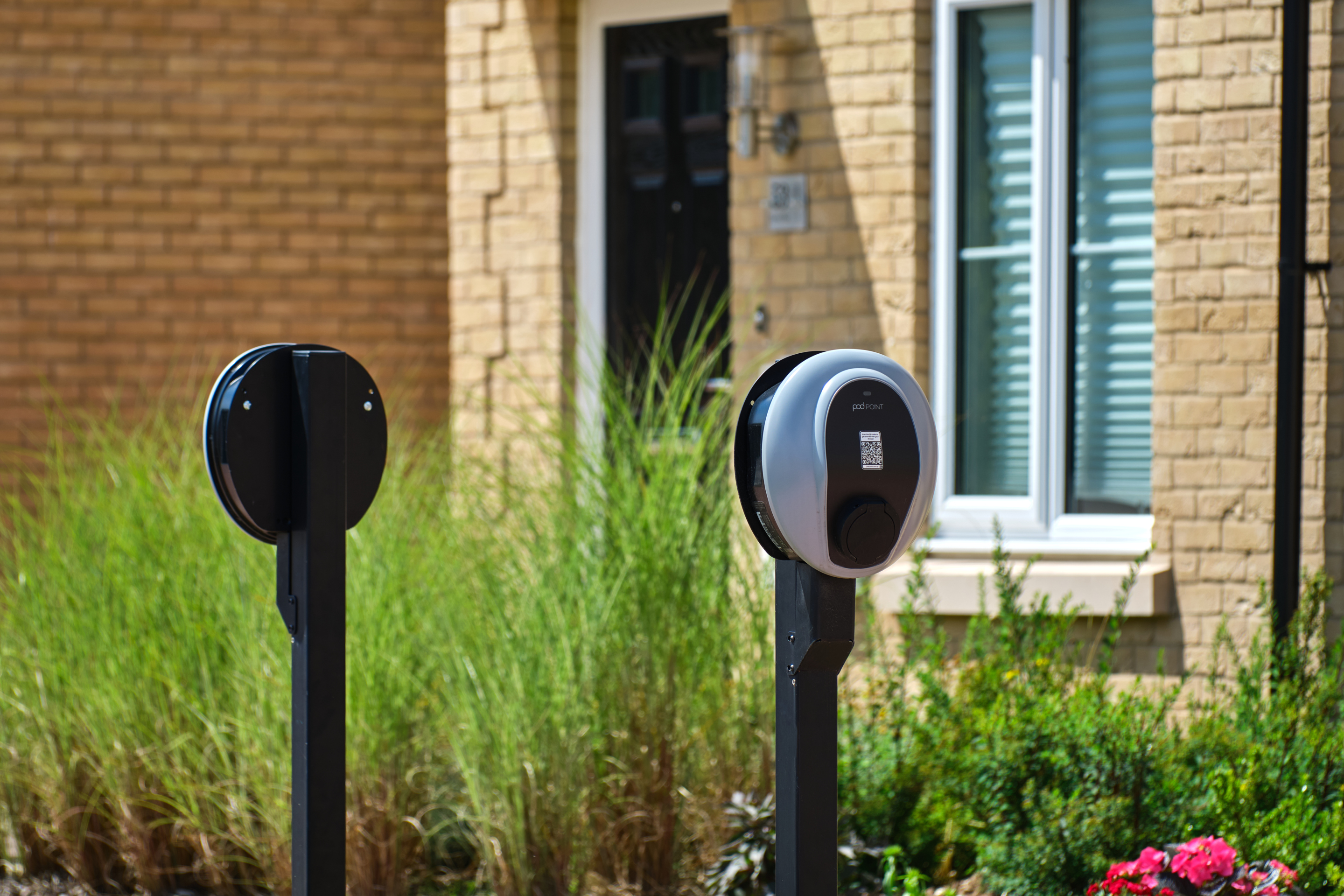
The new homes for Hampton Magna will be built to be low carbon.
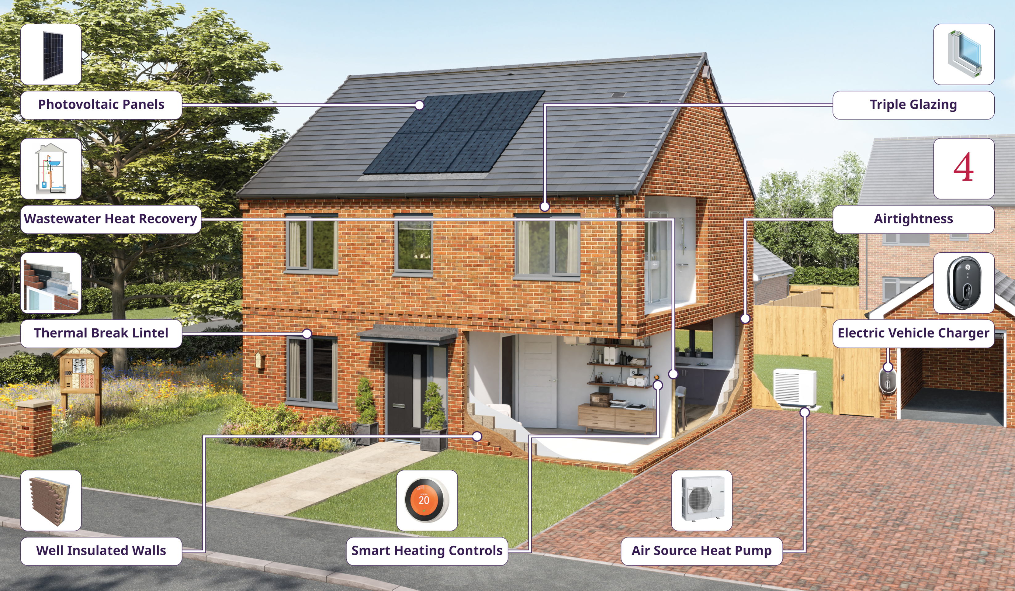
Sustainability measures within a typical Taylor Wimpey home when built to Future Homes Standard
Investing in wider community infrastructure
A key consideration with a planning proposal such as this is to ensure that local services receive the investment they need to accommodate housing growth in the local area.
The development will generate significant investment into key local infrastructure such as healthcare and education, and investments made will be informed by consultation carried out by Warwick District Council with statutory bodies such as the local NHS Integrated Care Board and the local education authority.
Any investment will be secured via a legally-binding agreement (called a Section 106 agreement) between Taylor Wimpey and the Council. A proportion of the Community Infrastructure Levy (CIL) generated by the development will also be paid directly to Budbrooke Parish Council for investment into local projects.

The development will generate significant funding for key infrastructure such as healthcare and education, to be determined in consultation with the NHS, local education authority, the local highways authority and other statutory consultees.
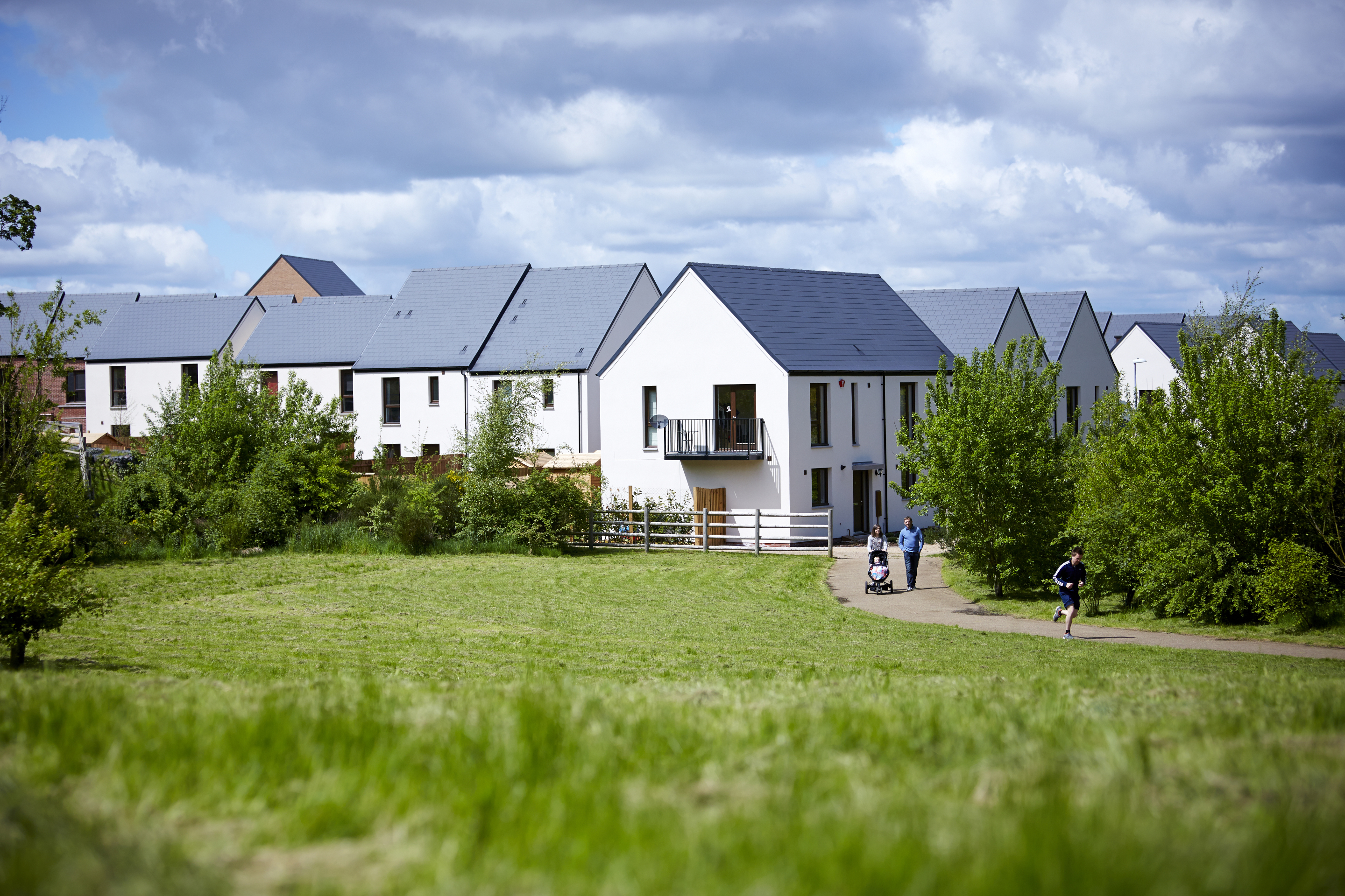
Green infrastructure
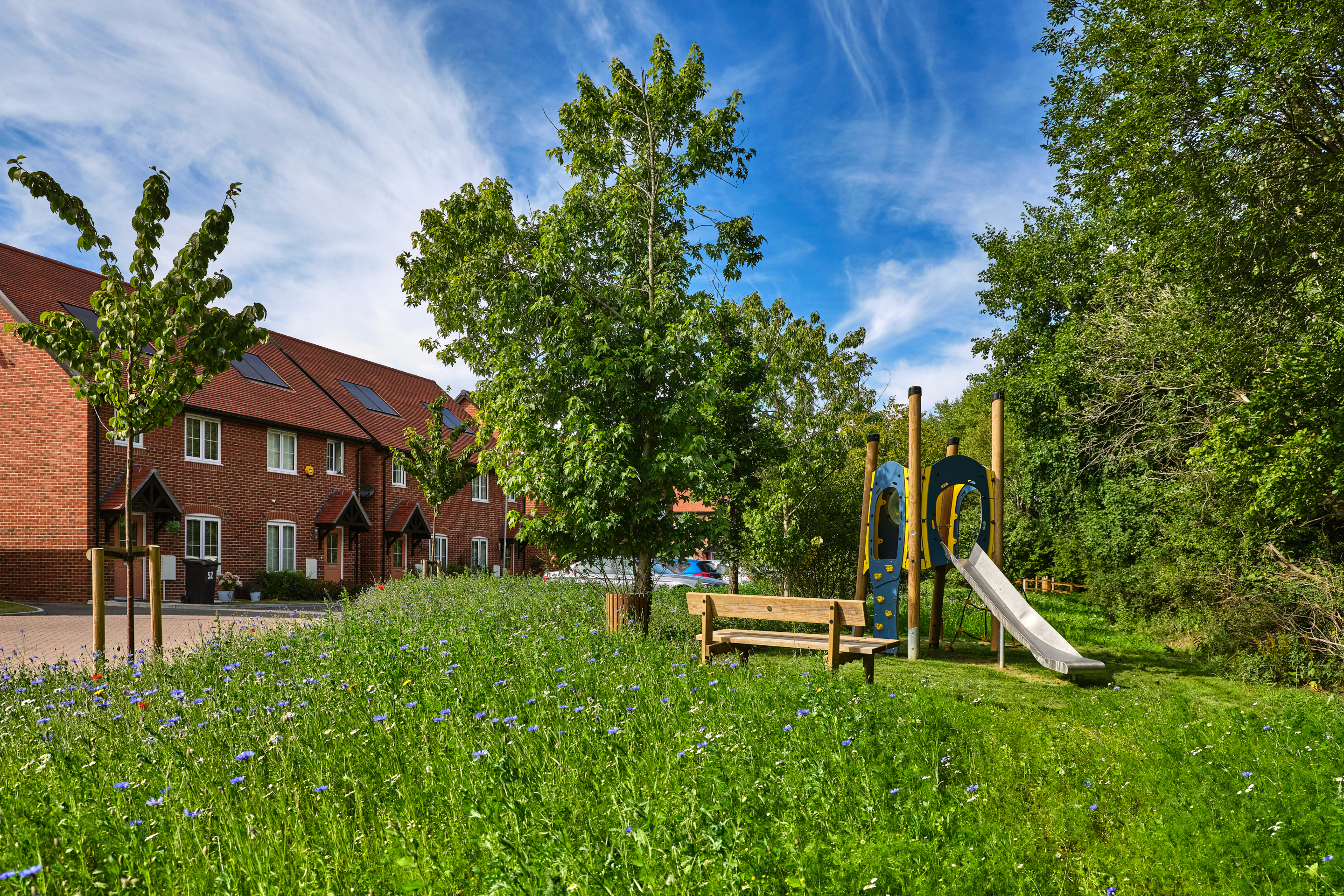
Alongside the delivery of much needed high-quality new homes, the proposed development will also see a significant proportion of the overall site area retained as open space. This will include extensive landscaped public open space, providing public recreational opportunities and areas for biodiversity enhancement.
A network of walking and cycling routes will be set within the extensive new public open space which will also provide play areas, biodiversity areas, and a potential community garden or orchard for food growing. There is also the potential to connect the new footpath network to existing public rights of way which will be retained and enhanced as part of the proposals. The potential to provide a direct pedestrian and cycle link to Warwick Parkway railway station is also being explored.
Use the feedback questionnaire to let us know what kind of outdoor facilities you would like to see provided if possible.
Outdoor recreation at existing Taylor Wimpey developments
Ecology and landscape
The site comprises arable farmland which is of relatively low biodiversity value. It is generally well contained from the surrounding countryside by existing development and established vegetation to its boundaries. There is little variation in topography at the site, with the land gradually rising towards the north-eastern edge of Hampton Magna, levelling along the crest of the ridge before falling towards the east.
From the outset, the development proposals have been landscape-led, being shaped as much as possible by existing landscape features such as hedgerows, trees and field patterns. There is an opportunity to provide a strong landscape framework at the edges of the site to soften the visual effect of the new development.
The landscape-led approach will see the retention of existing higher-value habitats such as mature trees and hedgerows at field boundaries. Significant additional planting is proposed to increase tree cover across the site and provide habitat enhancement for wildlife. There is also the opportunity to create ecological habitat enhancement through the creation of new attenuation basins across the site. These attenuation basins will collect surface water runoff from the site and will be planted with suitable vegetation to encourage wildlife.
Landscape consultants have assessed that the effects of sensitively designed development on views would be limited to a small area, and the proposed development would be seen in conjunction with the linear transport corridors and the existing settlement edge of Hampton Magna and would not appear prominent in the open countryside.
The majority of the site will be retained as public open space with significant new planting, delivering biodiversity net gain in excess of policy requirements.
Building with Nature
Taylor Wimpey is proud to be a member of the Homes for Nature programme. This will see the installation of nesting bricks/boxes in every new home and hedgehog highways between gardens.
Access and connectivity
The new neighbourhood is proposed to be formed of two main parcels. The larger northern parcel would have a primary vehicular, pedestrian and cycle access from Old Budbrooke Road, leading to a tree-lined primary street from which secondary streets will provide access to development areas. This access will comprise a new ghost island right-turn junction from Old Budbrooke Road. The junction will be provided in accordance with the Warwickshire Design Guide, with visibility splays of 120m in both directions from a point 2.4m behind the proposed give way line. This exceeds the visibility requirements for 40mph roads.
A secondary vehicular, pedestrian and cycle access to the northern parcel is proposed from Arras Boulevard. As with the primary access, this will be in accordance with the Warwickshire Design Guide. Visibility splays of 43m can be achieved in both directions from a point 2.4m behind the proposed access give way line, which is in accordance with Manual for Streets (MfS). A new 3m wide shared footway/cycleway is proposed along both sides of the new access, which will tie into existing pedestrian infrastructure on Arras Boulevard.
It had previously been proposed that the smaller southern parcel of development would be served by a vehicular, pedestrian and cycle access from Gould Road. However, this has now been removed in response to consultation feedback, with pedestrian and cycle access only now proposed at this location. Vehicular access to the southern parcel is now proposed via a direct internal link from the northern parcel within the development site.
Any traffic impact of the proposed development is being tested in accordance with Warwickshire County Council’s (the local highways authority) requirements. The test will assess the potential impact of the proposed development across the local and wider highway network. Whilst direct mitigation is unlikely to be triggered, it is expected that the proposed development will generate investment into local highway infrastructure improvements, to mitigate the cumulative impact of development. This would be in accordance with the Warwick District Infrastructure Delivery Plan.
The outline application is supported by a transport assessment which sets out how traffic impacts have been assessed to ensure that the development can be accommodated without significantly impacting the existing network.
Sustainable travel and parkway link
The emerging proposals place a focus on maximising opportunities for active travel as part of a sustainable transport strategy for the new neighbourhood.
There is an existing public right of way (W79/WB13) passing through the proposed development on a broadly west to east path. This route will be retained and enhanced within the development through a landscaped corridor. Alongside this, the proposed development will deliver new segregated cycleways throughout the site, providing a network of sustainable links throughout the new neighbourhood. This new network of walking and cycling routes will be designed to be consistent with both Active Travel England (ATE) and Local Transport Note (LTN)1/20 standards.
Warwick Parkway railway station is located immediately north of the site. An opportunity has been identified to provide a new pedestrian and cycle link between the proposed development and the train station. This would also provide a link for the wider community, reducing journey times between the settlement and the station, helping to make sustainable travel an attractive alternative for residents. This link would comprise a pedestrian and cycling access route between the site and the station’s existing bridge structure on the southern side of the railway line. Constructive discussions are ongoing between the relevant stakeholders on the delivery of this connection.
The active travel network being provided within the site includes a connection that could facilitate an onward pedestrian/cycle connection across the A46 utilising the existing farm bridge. However, any such onward link would involve land outside our control and will therefore be dependent on the future plans of those controlling land to the east, as well as the support of the council.
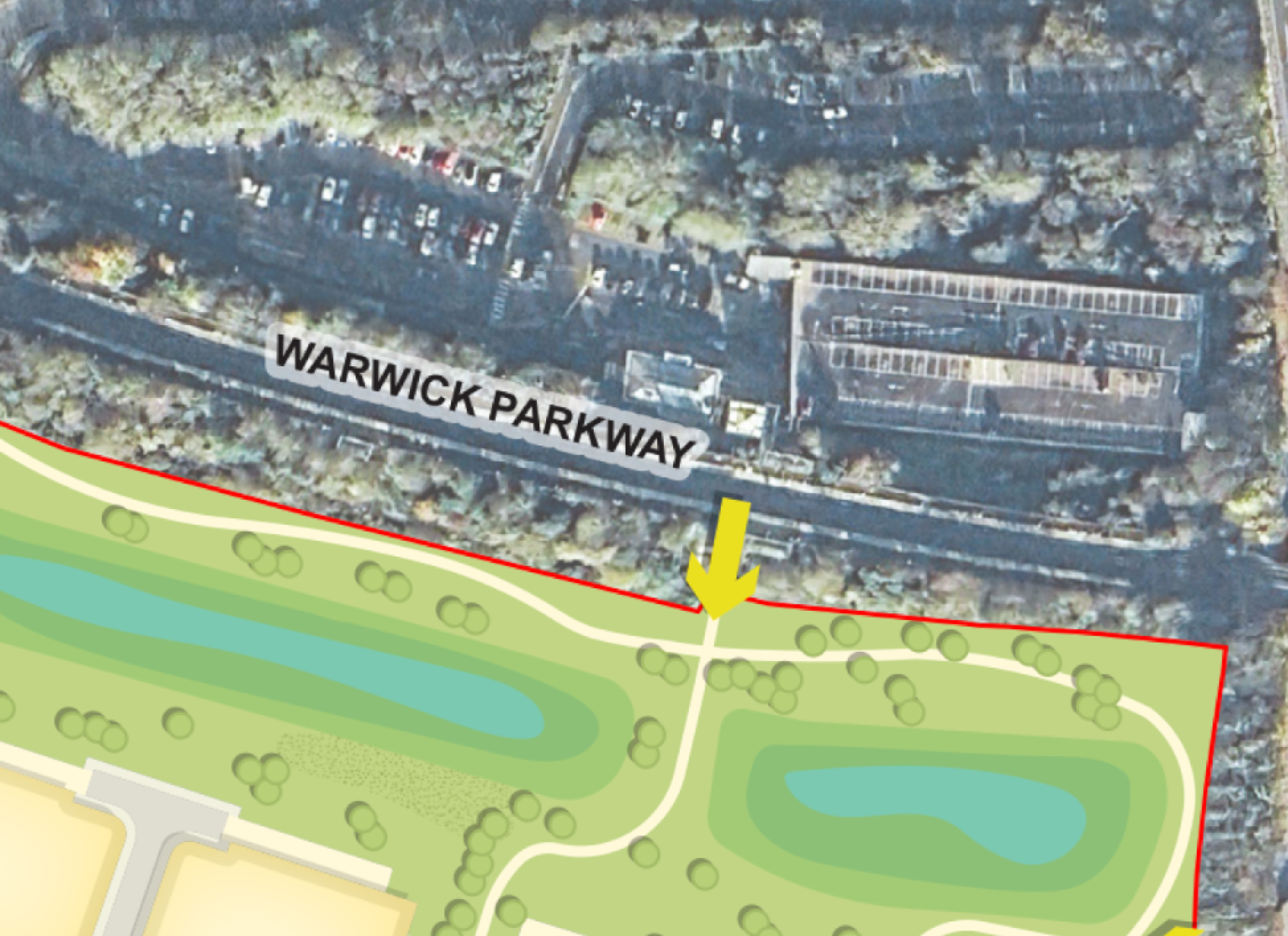
The proposals include a potential active travel link directly from the development to Warwick Parkway railway station - click to enlarge
Drainage
The site area is located in Flood Zone 1 of the Environment Agency’s flood map for planning, meaning it is at the lowest risk from flooding and is acceptable for housing development.
Surface water drainage will be managed by a sustainable drainage system (SuDS), incorporating attenuation basins at key locations across the site. These will collect surface water runoff from the proposed new neighbourhood. This will ensure that surface water discharge rates do not exceed existing levels and, where possible, will provide betterment over the existing surface water drainage on the site and in the surrounding area. With appropriate planting, the proposed attenuation areas will also deliver biodiversity benefits through the provision of additional wetland habitats.
Archaeology and built heritage
There are four designated heritage assets within 1km of the boundary of the proposed development site, comprising two Grade II Listed Buildings and two Conservation Areas. There are no designated heritage assets within the proposed development site.
A desk-based assessment of the historic environment baseline conditions at the site and a 1km buffer of the site boundary is being undertaken. The report will set out the heritage significance of known, and as yet unknown, heritage assets (both designated and non-designated). It will also include an assessment of any likely effects of the proposed development on these assets, with conclusions and recommendations to avoid, reduce or mitigate any potential effects.
Other technical considerations
In preparing an outline planning application for the proposed development, a full suite of technical studies is being completed, including highways, flooding and drainage, ecology, utilities, noise, heritage, contamination etc. The results of these studies will be reviewed and considered as plans progress and will be submitted along with the outline planning application. However, it is not anticipated that there will be any significant technical constraints to delivering a high quality, sustainable new neighbourhood at this site.
Your feedback
Once you have reviewed the information above and viewed the concept masterplan on our interactive map, please take a moment to complete our short feedback questionnaire.